
GIS Workshop on the 21st of August 2023
The inter-project workshop “Introduction to GIS (ArcGisPRO) for Historical Studies offered historians from the projects GLORE and Negotiating Migration Regimes conceptual, theoretical and practical insights into working with geoinformation systems. The focus was on the one hand on the presentation of examples from research practice and on the other hand on the practical application based on exercise examples. The program was structured in three blocks as follows.
Block 1: Conceptual and theoretical aspects (10:00-11:30)
1. Introduction to GIS for Historical studies and Overview What is GIS? The potential of GIS for Historical studies. Sources, data and their spatial references.
2. Between visualization and analysis: use cases and use of HGIS. (Guest lecturer Peter Hinterndorfer)
Block 2: Hands-on workshop: Examples from practice (13:00-15:30)
3. Historical sources and geodata: From the source to the map (geodata in sources, geocoding, preparation of data for HGIS, data cleaning).
4. Spatial patterns, trends and indicators of emigration and remigration: resettlement via airplane (display of points and lines, visualization of spatial statistics)
5. Flight, transit and emigration: escape routes, life on the run and arrival and life in the destination country. (Georeferencing of maps and tracing of individual fates).
Block 3: Excursus and Wrap-up (15:45-16:30)
6. Storymaps: Digital mediation and exhibition (using the example of Matyas Mervay’s storymap.
7. Reflection: joint discussion on possibilities of implementing GIS in one’s research project, potentials and challenges, space for questions and suggestions.
In addition to an introduction to the basic aspects of data processing in GIS, the first block primarily discussed the preparation of historical sources for import, analysis and visualization in ArcGIS-Pro, from a source-theoretical perspective. Methods of linking location-based historical data with geodata (geocoding) that can be processed in common software took a central role.
Insights into practice were offered by Peter Hinterndorfer, who presented his research based on his dissertation project Spaces, borders and accessibility in National Socialist forced camps in the context of historical-archaeological sources from the field of historical archaeology. The lecture was able to illustrate the broad spectrum of use cases of HGIS and the synergy potentials between archaeological and historical research.
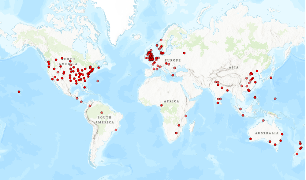
After a lunch break, the “hands-on” part of the workshop followed. Here, based on prepared exercise training datasets, the central steps of source analysis, data extraction and processing up to geocoding and visualization were worked through in practice. For example, it was possible to visualise the declared places of origin of UNRRA staff working in China until 1948, based on a personal database provided by Jiayi Tao. The GIS-Lab of the University of Vienna offered the optimal working environment since all participants had access to a full version of ArcGIS-Pro.
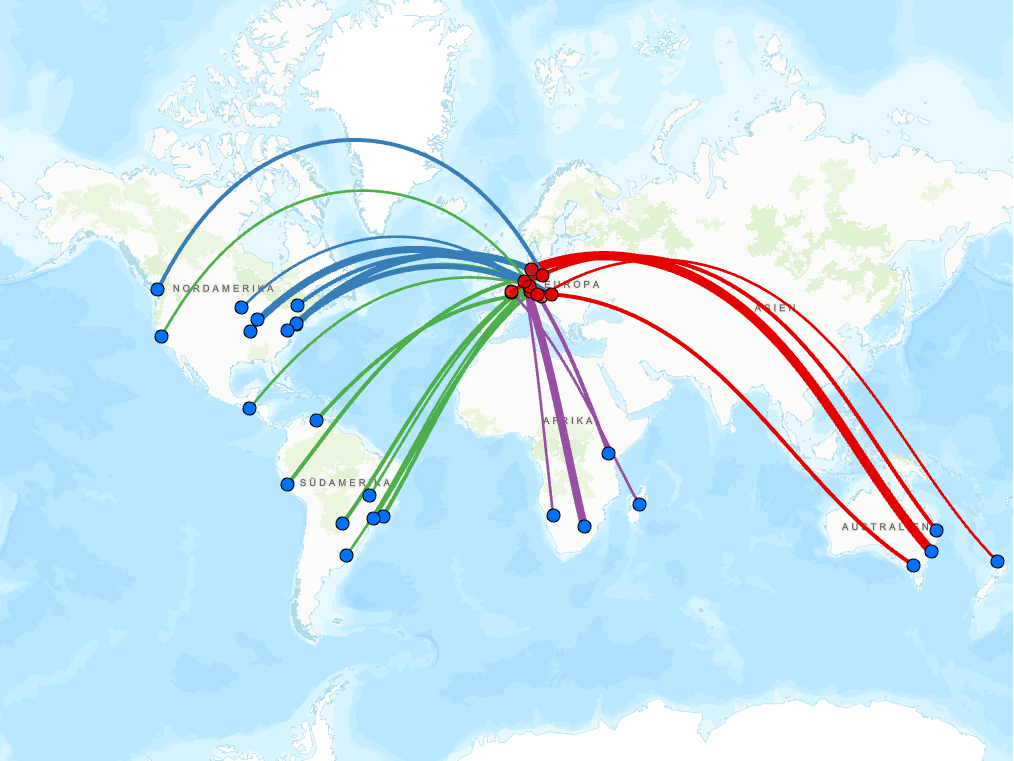
Since the visualization and analysis of migration routes of different DPs play a central role, especially in the ERC project “GLORE”, the resettlement of DPs after 1945 via airplane was schematically visualized based on a non-representative exercise sample. The work with point and line attributes as well as the possibilities to highlight the attribute variation in color and size were central aspects of this exercise sample. The hands-on part was concluded by an example of spatio-temporal tracing of individual fates as well as the methodology of georeferencing city maps and aerial photographs.
The final block offered space for reflection. Here, on the one hand, the possibilities of HGIS for public history were discussed again using the example of Matyas Mervays storymap. On the other hand, in addition to the joint discussion of central questions and comments, the recently published EHRI Repository was part of the discussion. This repository provides an extensive amount of historical geodata sets and is a helpful basis for contemporary historical research with geoinformation systems, especially due to its open-source character.
The aim of the workshop was to convey theoretical as well as practical steps of the process of historical research with the help of GIS. Through source-theoretical considerations, joint reflection on possible use cases as well as interactive workshop elements, the requirements and potential of HGIS were to be made transparent. In addition, the participants were to be taught basic knowledge and skills for the use and further deepening in the use of GIS. Both the practical examples and the concluding discussion indicated that these goals have been achieved to a large extent.